Kingsbury Stinger Trail, Stateline, Nevada
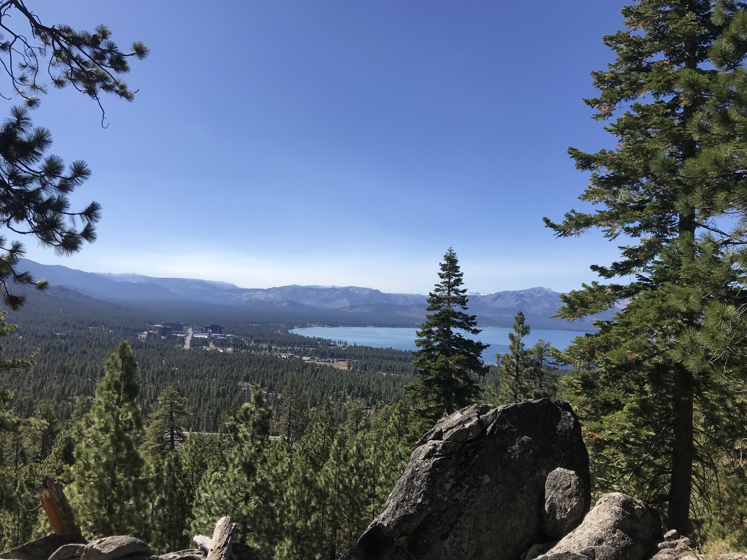
I think I have a new favorite trail on the south shore of Lake Tahoe - the Kingsbury Stinger trail in Stateline, Nevada. The climb isn't terrible and the downhill is super fun ride, with a mix of fast, bermed switchbacks and rocky features. Add in incredible views of Lake Tahoe, and you've got an amazing trail!

Kingsbury Stinger Trail // tahoefabulous.com
Check out my Kingsbury Stinger Trail Video here.
The Kingsbury Stinger trail was built in 2016 as a reroute of an old, eroded moto trail as a project of TAMBA and the US Forest Service. The route we did was about 10 miles and 1,450 feet of climbing. Kingsbury Stinger is accessed from a neighborhood off of Kingsbury Grade/Highway 207. The trailhead is on Terrace View Drive (which is listed incorrectly as Terrace View Street on Trailforks, so Google Maps won't find it!), and there's street parking near the trail. Click here for a map to the Kingsbury Stinger trailhead and street parking.

Kingsbury Stinger Trail // tahoefabulous.com

Kingsbury Stinger Trail // tahoefabulous.com

Kingsbury Stinger Trail // tahoefabulous.com
While you can ride all the way up on the regular Kingsbury Stinger trail, we cut off about a mile and a few hundred feet of climbing by using the Lower Stinger Shortcut, which is accessed by climbing up about a tenth of a mile on Terrace View Road. The access point for this trail is on the right, and easy to spot. I highly recommend using this shortcut for the climb up, especially as the lower part of Kingsbury Stinger is pretty sandy.

Kingsbury Stinger Trail // tahoefabulous.com
The climb up to the top of Kingsbury Stinger is a steady climb, punctuated by some really steep stretches and a few techy sections that I had to hike up. It was also pretty sandy, which makes the climb feel even longer than it actually is. There are not really any notable downhill sections during the climb up, but there are a few easier climbing and flat stretches to give you a break. There are some pretty incredible views of Lake Tahoe along the way also, so I stopped to admire the view quite a few times. At about mile 4.1, you'll cross the Tahoe Rim Trail, which is a sign that you're almost to the top!
Kingsbury Stinger Trail // tahoefabulous.com
The climb tops out after about 4.6 miles and 1,275 feet of climbing at 7,950 feet. Here we took a break to have a snack and get ready for the long downhill to the bottom. I was a little nervous about the downhill, since some of the rock features seemed pretty challenging on the ride up, and the lower part of the trail was pretty sandy and loose. We rode the trail in early October, not too long after the area had gotten some rain and snow, so we were expecting the trail to be in decent shape. The decomposed granite sections were really loose and blown out - I had forgotten how quickly those dry out in the fall. The dirt parts of the trail were dusty and a little unconsolidated on the lower half of the trail, but there was some nice tacky dirt near the top where the snow had hung around longer. Next year, we're going to ride it in the spring or early summer!

Kingsbury Stinger Trail // tahoefabulous.com
That said, the downhill was incredibly fun! Having good tires and riding under control makes a big difference, but I never felt like I was going to slide out in the sandy turns. As for the rock features, I was able to ride all of them. On a couple of the more challenging ones, I rode up to and got a look first, but I found everything rideable. Most of the features had very visible ride outs, so I could see where I was going, and there weren't really features built on blind corners, which I struggle with.

Kingsbury Stinger Trail // tahoefabulous.com
We planned to ride all the way down on Kingsbury Stinger proper, and at about mile 8.7, we crossed the intersection with the Lower Stinger Cutoff. Now we were riding blind! This section was pretty loose and involved a ~0.4 mile climb in strength sapping sand, pretty late in the ride. I wasn't super into this part. At about mile 9.5, we did get to go down again. The last part of Kingsbury Stinger was a mix of single and double track sandy whoops and loose descents. Sandy whoops are not usually my favorite, but for whatever reason, I had a blast on them this time. Maybe it made me nostalgic for when I was first learning to mountain bike in South Lake Tahoe, and ALL the trails had sandy whoops sections? After that, we popped back out in the neighborhood, right by our car. This was such and awesome ride, and I'm excited to ride it again next year!
Trail Stats:
Location: Kingsbury Grade, Stateline, Nevada
Difficulty: Intermediate
Mileage: 10 miles
Elevation Gain: 1,430
Click here for my Strava track
Washoe Land