Mountain Biking Dry Pond Loop, Reno, NV

Dry Pond Loop // tahoefabulous.com
With this super long winter we've been having, I've been having so much fun exploring the trails in the lower elevations surrounding Truckee. Last weekend, Greyson and I checked out some new-to-us trails in the Mount Rose area of Reno, as you might have seen in my video. We rode the Dry Pond Loop counterclockwise, and it was a great intermediate ride, on the easier side of intermediate. It's about 6.5 miles and a little over 1,000 of climbing, with most of the climbing coming in the first half.

Dry Pond Loop // tahoefabulous.com

Dry Pond Loop // tahoefabulous.com
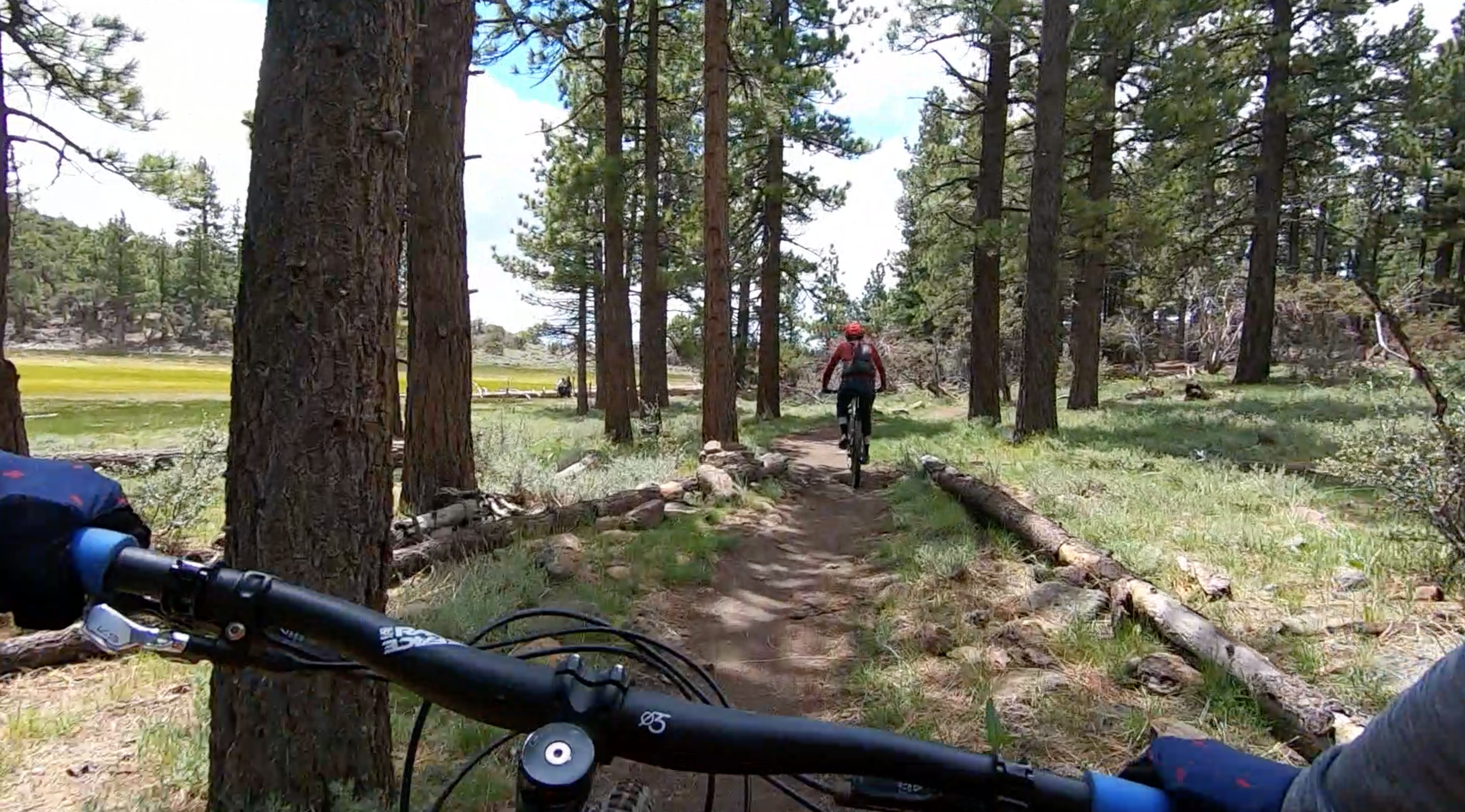
This loop is below Mount Rose in the Galena area, south and west of downtown Reno off of Highway 431. We parked at the Thomas Creek Trailhead parking area (Click here for Google Map directions) and headed up Thomas Creek Trail right from the large parking lot. This trail climbs steadily, but not too steeply along Thomas Creek through aspen groves and into the pines. We saw a ton of hikers with dogs on this section of the trail, but nearly everyone was very friendly. After about 1.5 miles and ~500 feet of climbing, Thomas Creek Trail intersects with the Dry Pond Trail.

Dry Pond Loop // tahoefabulous.com
Dry Pond Trail continues to climb, and the climb definitely gets steeper at this point, and there are a few very tight and steep switchbacks that I struggled with. Dry Pond trail takes you through a curly leaf mountain mahogany forest, which is really cool. I'd only ever seen bush sized mountain mahogany before. There are also really sweeping views looking down into the Washoe Valley.

Dry Pond Loop // tahoefabulous.com
After about 1.2 miles and another ~440 feet of climbing, we arrived at the dry pond that gives the trail it's name. We stopped here to have a snack and admire the awesome view of Mount Rose across the meadow. The Dry Pond Trail starts heading downhill almost immediately after the meadow, and the trail on the south side was pretty different from what we'd just climbed up. While the climb up was mostly dirt with some embedded rocks and roots, the downhill was looser, rockier and more exposed. It's all very rideable, but I was amazed at the quick change in the terrain.
Dry Pond Loop // tahoefabulous.com
At about mile 3.8, Dry Pond Trail intersects Whites Creek Trail. We turned left and continued down hill. Whites Creek Trail isn't as steep as Dry Pond, and it's back in the pines and aspen groves. The trail isn't a "flow trail", but I thought it was fast and flowy, with lots of little rock gardens and objects to pop off of that you can choose to challenge yourself on. It also gets a little sandy in spots, especially towards the bottom, and I imagine it will be even more sandy later in the summer. As we got closer to the end, we started to encounter more bikers, hikers, and dogs, but generally people were really friendly. Whites Creek Trail dead ends at N. Timberline Dr. where we turned left and headed the last half mile back to the car. There's a tiny bit of a climb back to the parking area, and my legs were dead at this point. It was almost comical how hard the less than 75 feet of climbing felt to me.

Dry Pond Loop // tahoefabulous.com
I really enjoyed riding the Dry Pond Loop. There were great views, interesting ecosystems, friendly people, and enough challenge to make it entertaining. I think this would be a great trail to take newer riders on.
Trail Stats
Location: Mt. Rose, Reno, NV
Mileage: 6.6 miles
Elevation Gain: 1,025
Difficulty: Easier Intermediate
See my Strava Route here!
Washoe Land