Hiking Castle Peak: Truckee, California
Last week, I climbed a new-to-me peak in the Truckee area - Castle Peak. If you’ve driven east into Truckee on I-80, you’ve probably seen this unique peak jutting into the sky. It’s noticeable mainly because of the distinctive south facing cliffs and turrets, leftovers from an ancient volcano. In the winter, Castle Peak is a popular snowshoe and ski destination and in the summer it’s great for hiking. When I went in mid-July, it was snow free and the wildflowers were incredible.
Castle Peak Hike // tahoefabulous.com
Castle Peak is a doable, but challenging summit off of the Pacific Crest Trail. There are a couple of different ways to access Castle Peak, and the route I took was around ~1,900 feet of climbing in just over 7 miles. While this hike doesn’t require any technical climbing, it’s a tough, steep hike at altitude with uneven, loose terrain, exposed to the heat of the sun and there are spots where a fall would result in serious injury. Plus, to get to the actual summit there is some class 3 scrambling. You should be in pretty good shape and have some technical hiking experience. Be sure to bring lots of water and the 10 essentials.

Castle Peak Hike // tahoefabulous.com
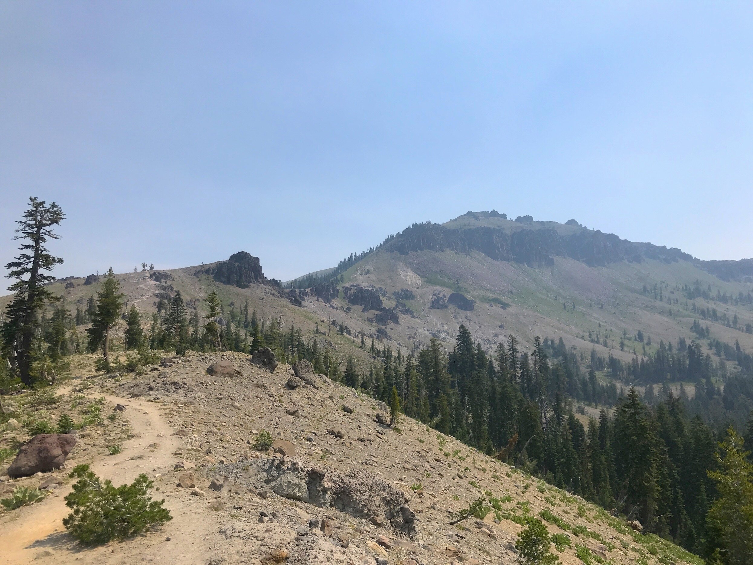
I started my hike at the parking area for the Donner Summit trails, just north of I-80 off of exit 176 for Castle Peak/Boreal resort. (For a longer hike with more time on the PCT, you could park on the south side of the freeway by Boreal Resort and get on the PCT right away.) From the parking area, head up the Castle Valley Fire Road. Pretty quickly past the gate, there’s a great view of Castle Peak to the right, but it’s kind of intimidating to see how far you’ll have to climb!

After about 0.56 miles, look for a double track trail to the right. There should be a trail marker for the Donner Lake Rim Trail, where you’ll head down for a bit before beginning to climb. After about 0.4 miles on the DLRT, the Pacific Crest Trail intersects the DLRT, and you’ll turn left and start heading north. Here the climb is pretty mellow and shaded - enjoy it while it lasts! When I hiked it, there were a ton of corn lilies in this section. At about 1.2 miles on the PCT, there is a sharp right uphill to a signed intersection.

Castle Peak Hike // tahoefabulous.com
Follow the signs to Castle Peak and take the trail on the right, Castle Peak West Trail. Now this is when things get challenging! The trail climbs 1,100+ feet in just over a mile, and much of the trail is loose and sandy, making footing a challenge. I took a ton of breaks in this section, stopping to catch my breath, check out the unique rock formations, drink water and enjoy the views. Unfortunately, it was a little hazy the day I did the hike with smoke from a fire near Susanville.

Castle Peak Hike // tahoefabulous.com
There’s a steep climb to a small saddle before the final push to the summit - be sure to take advantage of this relatively relaxed section to take it easy. There are lots of little social trails to the summit from here. It seemed to me that they all reconnected fairly quickly, as long as you keep heading towards the summit. The trail is steeper on the last push, but at least there are some shady spots. If you want to get to the true summit of Castle Peak, you’ll have to scramble down past the west summit and back up again with some class 3 climbing up to the top.

Once you’re there, enjoy a snack break, soak in the 360 degree view and get mentally ready for the hike down. Honestly, I struggled more on the hike down than the climb up. The loose, sandy steep sections took nearly constant attention not to slip and fall. It was stressful! I didn’t bring trekking poles, but I wished I had, especially on the sketchy downhill. However, the hike down gets a lot easier as soon as you’re back on the PCT, and then it’s easy sailing back to your car.

Castle Peak Hike // tahoefabulous.com
Via Strava

Castle Peak Hike // tahoefabulous.com
Trail Stats:
Location: Truckee, California (parking here)
Mileage: 7.12 feet
Elevation Gain: 1,917 feet
Difficulty: Advanced
Nisenan & Wašišiw Ɂítdeh (Washoe) Land